There’s a new blog entry at ESRI’s Mapping Center that describes how to use variable depth masking to improve the readability of labels on data-dense maps. In the article, a contour map is created with variable depth masking applied to the labels. This technique hides portions of layers under the labels, which makes them easier to read. An ArcInfo-level license is needed to use variable depth masking.
Monthly Archives: November 2011
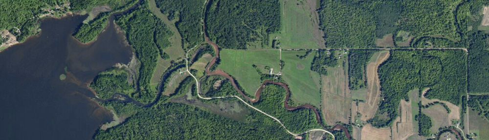
Borders and changes in technology
A history of the US-Canada border (which brings to light some realities of surveying in the 1800s) was recently posted on the NYT blog, found here. For more historical border issues (errors later pointed out using newer technology – GPS), see the Deseret news and the NOAA response.
The NOAA rebuttal is an interesting argument: even though a specific monument (the Four Corners marker that sits between Utah, Colorado, Arizona, and New Mexico) is at a location other than its intended coordinates, it doesn’t invalidate the boundaries between these states, nor does the meandering of the US-Canada border along the 49th parallel call into question the location of the border with our northern neighbors. The (connected) monuments, placed between 1872 and 1874, define the boundary, even if they do ‘wander’ across the parallel.
Given the tools surveyors had to work with in the 19th century, and the terrain they were crossing, the border between Minnesota and Washington is amazingly straight. It’s the development of newer tools (GPS and Google Earth, among others) that lets us discover such errors with relative ease.
On a final note, the Four Corners is a unique place in the U.S. It was even parodied in an episode of The Simpsons.
U.S. road accident casualties mapped
see http://www.guardian.co.uk/news/datablog/interactive/2011/nov/22/us-road-accident-casualties? for a map of eight years of traffic deaths, broken out by class, age, and year of fatality.
GIS – a revolution by stealth
Happy GIS Day!
Happy GIS Day! More information about GIS Day can be found at http://www.gisday.com/ and some great videos about geospatial technologies at http://geospatialrevolution.psu.edu/
Georeferencing scanned images in ArcGIS
Georeferencing is the process of assigning a coordinate system to a scanned image (map, aerial photo) in GIS. A georeferenced image does not have all scale (vertical scale) distortion removed, so if you georeference an air photo with a large amount of vertical relief across the scene, the scale of the image and the accuracy of the alignment will vary across the scene. For scanned maps, the fit should be better, as nearly all maps are planimetric (designed with scale distortions removed).
To georeference a hardcopy map or photo, you will need both a high-quality scan of the original, plus a reference layer. The reference layer can be in any coordinate system, but you should have five points that you can see on both the scanned image and the reference layer. These should be features that are unlikely to move over time, such as road intersections, bedrock outcrops, or street corners.
Once georeferencing has been applied to your scan, you may use it in conjunction with other layers either as a backdrop for a map or as a source from which you can create new features. The quality of the original map or photo, the resolution of the scan, and your ability to locate high-quality control points will all affect how well the georeferenced image will fit with other features in your GIS.
Here is a document that describes the georeferencing process in ArcGIS. The instructions should work for both ArcGIS 9.x and 10.x.
7 billion people
The Earth’s population reached seven billion this week. Nearly 1/3 of the total live in China and India.
How do different nations compare in terms of population, life expectancy, and growth? See http://mapstories.esri.com/7billion/ for some interactive maps showing these metrics.
ESRI releases 2010 U.S. Census data
Today, ESRI released additional 2010 Census data to the public. Downloading and formatting Census data can be very time-consuming, so this resource is a real boon to users of Census data.
Additional resources and articles from ESRI can be found on their news page.